BC Landpro Group, LandQuest® Realty Corporation Marketing British Columbia To The World®


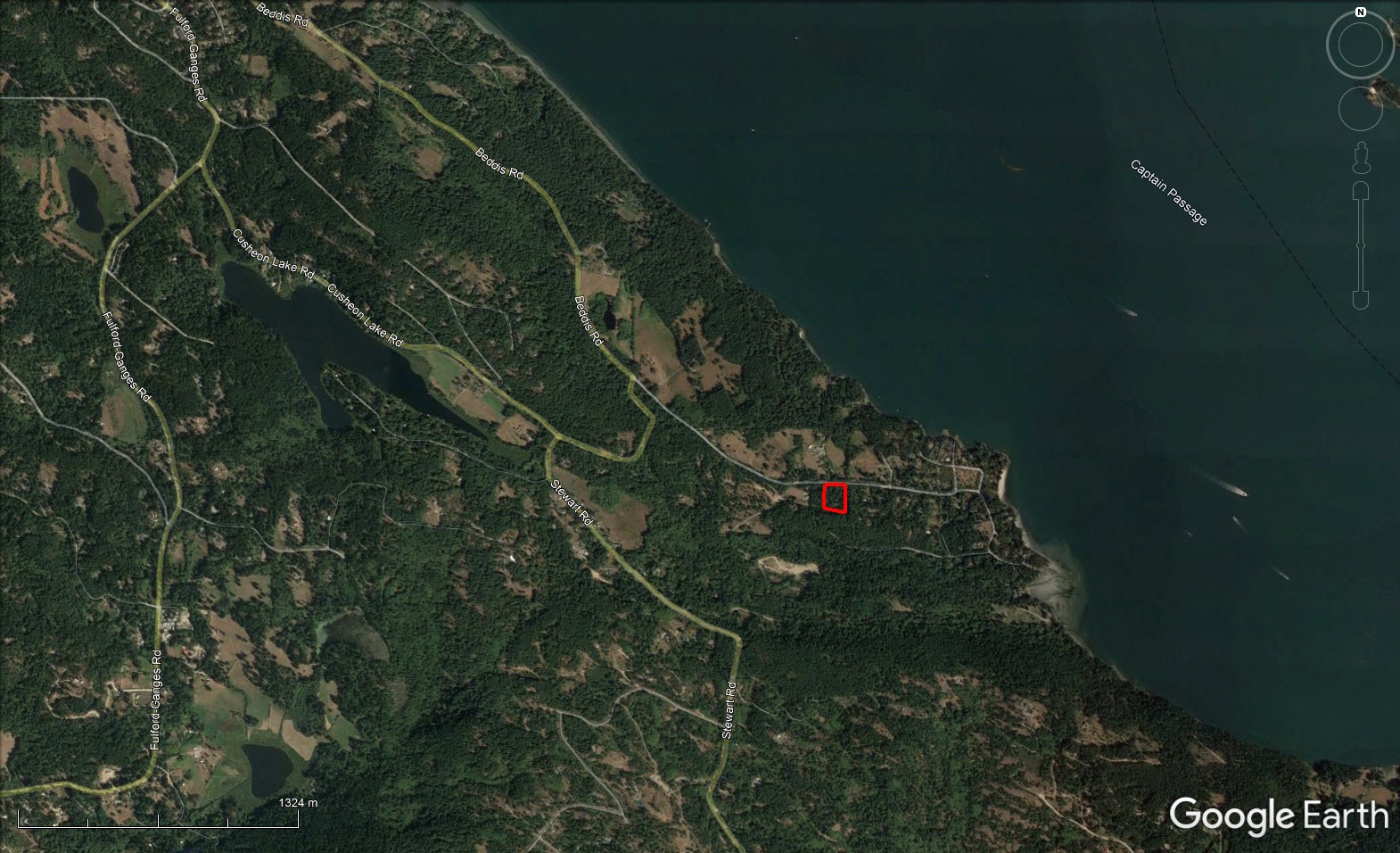


Sunny, private and forested building lot conveniently located within walking distance to Beddis Beach and a ten minutes’ drive to either Ganges or Fulford Harbour. Driveway has been put in and zoning permits a main home, 602 sq ft cottage and shop.
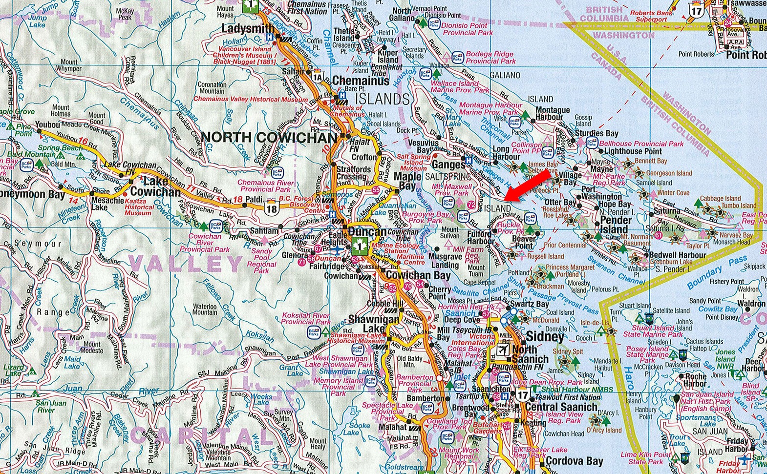
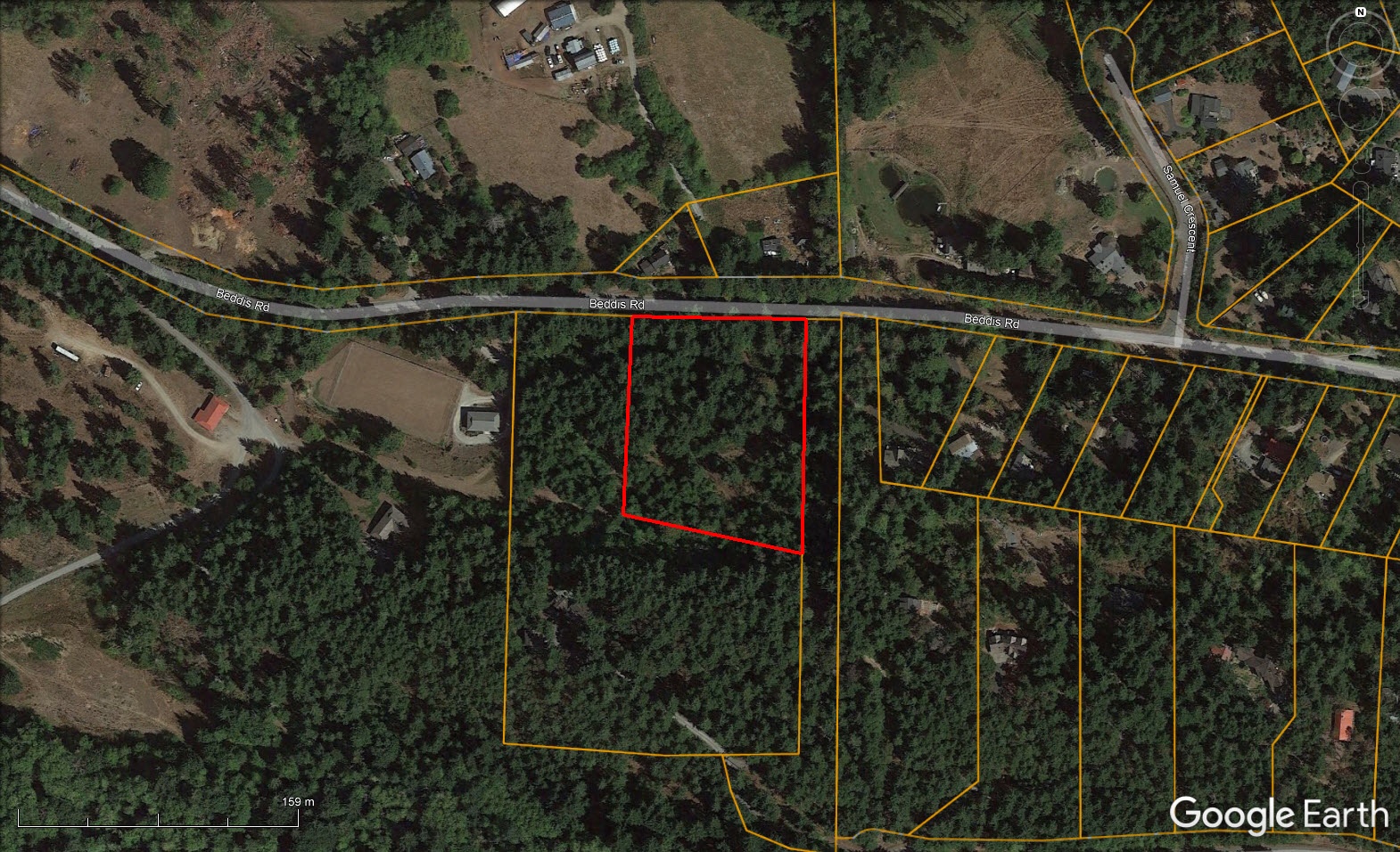
This 3.04 acre building lot is located at the South end of Beddis Road, only a 10 minutes’ drive to either Ganges or Fulford Harbour. It is within walking distance to Beddis Beach, one of the most popular beaches on Salt Spring Island. Cusheon Lake is also close by, along with many hiking trails.
The lot is private, forested and has excellent sun exposure. With some tree removal or limbing, there is potential for ocean views. The lot is unimproved, other than a driveway has been put in. The Capital Regional District water system is located nearby with the potential to connect to it, along with hydro power.
RU1 zoning allows for a main home, 602 ft2 seasonal cottage and workshop. The tiered slope allows for multiple building sites. Call to book your appointment to view today!
Contact Listing Agent
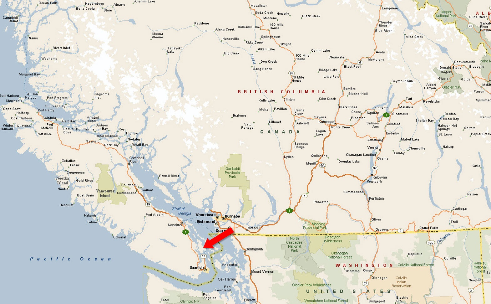
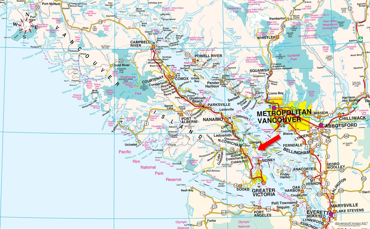
Salt Spring Island is the largest, most populated (over 10,000 residents), and some might say most popular, of the Southern Gulf Islands. It is located between Vancouver Island and the Mainland in the Strait of Georgia alongside its neighbouring islands of Galiano, Pender, Saturna, Mayne and Prevost. The setting is West Coast Canadian; forested islands, wide meadows and beautiful landscapes surrounded by emerald ocean and wonderful vistas. It is the only Southern Gulf Island with a high school and a hospital.
Salt Spring Island is 27 km (17 miles) long and 14 km (9 miles) wide (74 sq miles), with 133 km (83 miles) of shoreline. The island attracts visitors and prospective residents with its mild climate and annual sunshine in excess of 2,000 hours.
Artists, farmers, chefs, mechanics, romantics, writers, retirees and dreamers have been drawn to its shores and have recognized it as one of the world's best places to stay. Renowned for its creativity, Salt Spring Island is known as one of North America's best small arts towns and, due to the high demand to live there and limited supply of land offerings, Salt Spring Island holds some of the most desired and priciest real estate on the entire west coast of North America. The famous Saturday Market displays a great cross-section of the high-quality arts and crafts from paintings to pottery, jewellery and clothing, weaving and woodworks.
Mount Maxwell Provincial Park is a day-use only park with one of the highest points on Salt Spring Island called Baynes Peak, which offers amazing views of Vancouver Island, the surrounding Gulf Islands and the mainland of British Columbia. Mount Maxwell Provincial Park shares a common border with Mount Maxwell Ecological Reserve and Burgoyne Bay Provincial Park, which together create over 1,100 hectares of protected area stretching from mountain top to shoreline and across Burgoyne Bay to the slopes of Mount Bruce.
Mount Maxwell Provincial Park is one of the largest protected areas in the Gulf Islands and includes a mosaic of habitats from estuary to Garry oak ecosystems. Old-growth Douglas fir forest and cliffs serve as important nesting areas for species at risk, including turkey vultures, peregrine falcons and several species of bat. The estuary has three species of salmon and Burgoyne Bay is home to eel-grass beds and seabird populations. Several threatened plant species are protected in the park, including scalepod, Gray’s desert parsley, California hedge parsley and elfin moss.
Mount Maxwell Provincial Park offers a number of walking and hiking opportunities with spectacular views. Approximately 6 km of maintained trails all start at the parking lot and range from easy strolls to more demanding hikes. Trails to the north and east travel through wooded areas of old-growth and second-growth Douglas fir. The trail to the west follows along the ridge of Mount Maxwell and links up with the park entrance road approximately 2 km from the parking lot.
Beaches, trails, cycling, hiking, diving, paddle boarding, kayaking, boating, golfing, whale watching, and various art and cultural events.
The name Salt Spring refers to a group of brine pools at the north end of the Island. The First Nations people called it Klaathem. The first group of non-aboriginal settlers arrived in 1859. Fruit growing, dairy farming and logging were the mainstays of the local economy. One successful enterprise was the Salt Spring Island Creamery, which produced prize-winning butter from 1904-1957. Ferry service began in 1930 when the 20-car Cy Peck began a regular run between the Island and Swartz Bay.
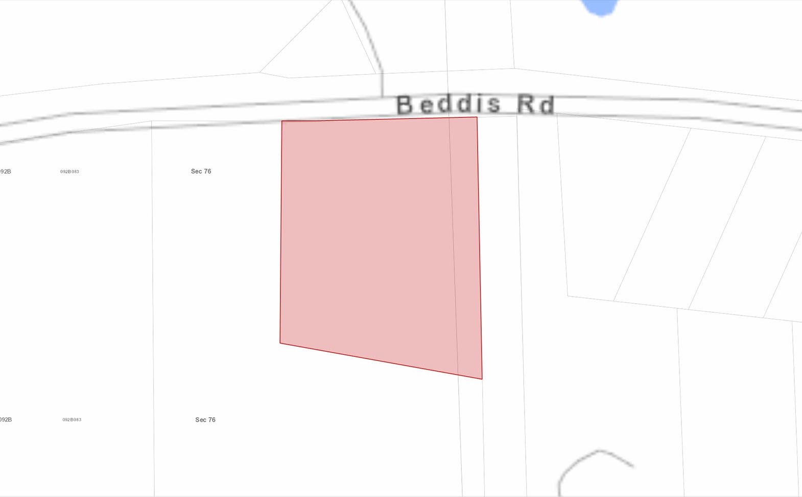
Please see mapping section (all boundaries are approximate).
48°48'33.68"N and 123°26'10.53"W
None
None
$2,758.17 (2021)
RU1 (Rural Uplands 1)
Islands Trust -Salt Spring Island Land Use Bylaw 355
Additional zoning information can be found on the Islands Trust website.
Lot A Section 76 South Salt Spring Island Cowichan District Plan VIP65163
PID 023-739-444
Buyers should verify any information provided that is important to them to their sole satisfaction. Our best efforts have been made to provide the most current and accurate information from sources believed to be reliable.


#101-313 Sixth Street, New Westminster, BC, V3L 3A7, Canada
JAMIE: 1.604.483.1605 | JASON: 1.604.414.5577
F: 1.604.485.4046 | E: sales@bclandpro.com
